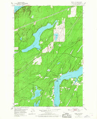
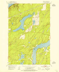
1953 Map of Mason Lake
USGS Topo · Published 1967About this map
Mason Lake dominates this mid-century landscape of Washington's Puget Sound region, serving as a focal point for the surrounding timberlands and early recreational developments. To the north, Twanoh State Park meets the waters of Hood Canal at Shady Beach, while the southern reaches are defined by the intricate shoreline of Pickering Passage and the northern tip of Hartstene Island. The Northern Pacific railroad tracks wind through the forested interior, tracing a route through the rugged drainage basins of Sherwood Creek and Deer Creek. Settlement is concentrated at water landings and small lakeside communities, including Hartstene and Walkers Landing. The presence of the Mason Lake Lookout and the Little Hoquiam Gaging Sta illustrates the era's focus on resource management and fire prevention in the densely wooded territory between the canal and the Sound.
Find a feature on this map
32 named features on this map. Tap any name to fly to it.
Don’t see what you’re looking for? This feature index may not catch every label — zoom into the map to look around manually.
Map Details
Editions of this 1953 Mason Lake Map
5 editions found
Other maps of this area

1937 · Olympia
USGS Topo · 1:62,500

1938 · Allyn
USGS Topo · 1:62,500

1939 · Shelton
USGS Topo · 1:62,500

1943 · Potlatch
USGS Topo · 1:62,500

1949 · Olympia
USGS Topo · 1:62,500

1952 · Potlatch
USGS Topo · 1:62,500

1953 · Vaughn
USGS Topo · 1:24,000

1953 · Lake Wooten
USGS Topo · 1:24,000
1953 · Mason Lake
USGS Topo · 1:24,000
1953 · Belfair
USGS Topo · 1:24,000