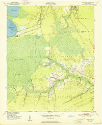
1951 Map of Masontown
USGS Topo · Published 1951About this map
Croatan National Forest dominates the landscape of this 1951 coastal survey, where the dense wetlands of Lakes Pocosin and White Oak transition into the headwaters of the Newport River. The map captures a unique coastal drainage system characterized by an intricate network of prongs and branches, such as Southwest Prong Slocum Creek and Milldam Branch. Human intervention is visible in the structured grid of the North Canal, Middle Canal, and South Canal near Camp Bryan. Local connectivity at mid-century relied on the Atlantic and East Carolina railroad and the descriptively named Nine Foot Road. Small settlements like Masontown and Havelock serve as focal points for the region, with Havelock Ch and a nearby Private Airstrip reflecting the community's local infrastructure during the early post-war period.
Find a feature on this map
46 named features on this map. Tap any name to fly to it.
Don’t see what you’re looking for? This feature index may not catch every label — zoom into the map to look around manually.
Map Details
Editions of this 1951 Masontown Map

Other maps of this area

1942 · Maysville
USGS Topo · 1:62,500

1942 · Swansboro
USGS Topo · 1:62,500

1948 · Maysville
USGS Topo · 1:62,500

1948 · Swansboro
USGS Topo · 1:62,500

1949 · Havelock
USGS Topo · 1:24,000

1949 · Newport
USGS Topo · 1:24,000

1949 · Salter Path
USGS Topo · 1:24,000

1949 · Mansfield
USGS Topo · 1:24,000

1949 · Cherry Point
USGS Topo · 1:24,000

1949 · Masontown
USGS Topo · 1:24,000