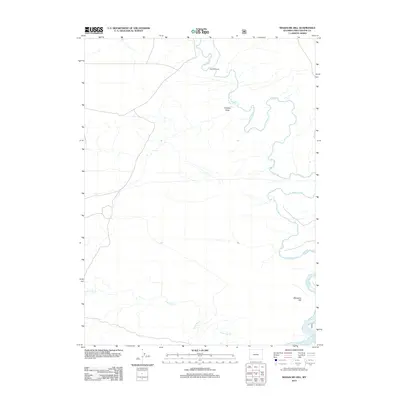
2012 Map of Massacre Hill
USGS Topo · Published 2012About this map
Massacre Hill dominates the southeastern corner of this high-desert landscape in Sweetwater County, providing a stark topographical anchor to the region's expansive drainage systems. The meandering path of the Blacks Fork river winds through the eastern portion of the terrain, while the multiple branches of Little Dry Cr cut across the southern reaches, illustrating the complex hydrology of this arid environment. Evidence of ranching and land use is sparse but significant, centered on the Bonomo Ranch in the north near the river's bend. This 2012 survey by the U.S. Geological Survey documents a quiet corner of Wyoming where landmarks like Chicken Draw define the subtle variations of the plains before they rise toward more prominent elevations.
Find a feature on this map
5 named features on this map. Tap any name to fly to it.
Don’t see what you’re looking for? This feature index may not catch every label — zoom into the map to look around manually.
Map Details
Editions of this 2012 Massacre Hill Map
This is the sole edition of this map. No revisions or reprints were ever made.
Other maps of this area

1954 · Rock Springs
USGS Topo · 1:250,000

1957 · Mc Kinnon Junction
USGS Topo · 1:62,500

1958 · Rock Springs
USGS Topo · 1:250,000

1961 · Little America
USGS Topo · 1:24,000

1961 · Peru
USGS Topo · 1:24,000

1961 · Bryan
USGS Topo · 1:24,000

1962 · Rock Springs
USGS Topo · 1:250,000

1964 · Antelope Knoll NE
USGS Topo · 1:24,000

1964 · Winter Fat Reservoir
USGS Topo · 1:24,000

1966 · Mc Kinnon Junction
USGS Topo · 1:62,500