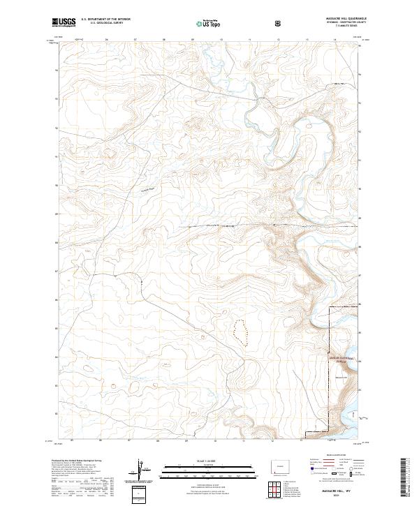
2021 Map of Massacre Hill
USGS Topo · Published 2021About this map
The winding course of Blacks Fork defines the rugged, high-desert drainage patterns of this corner of Wyoming. Located primarily within the public lands of the Ashley National Forest, the terrain is marked by deep erosional cuts and high points like the eponymous Massacre Hill. The map detail reveals a landscape defined by seasonal hydrology, where Little Dry Cr and Big Dry Creek carve paths through the plateau.
Find a feature on this map
12 named features on this map. Tap any name to fly to it.
Don’t see what you’re looking for? This feature index may not catch every label — zoom into the map to look around manually.
Map Details
Editions of this 2021 Massacre Hill Map
This is the sole edition of this map. No revisions or reprints were ever made.
Other maps of this area

1954 · Rock Springs
USGS Topo · 1:250,000

1957 · Mc Kinnon Junction
USGS Topo · 1:62,500

1958 · Rock Springs
USGS Topo · 1:250,000

1961 · Little America
USGS Topo · 1:24,000

1961 · Peru
USGS Topo · 1:24,000

1961 · Bryan
USGS Topo · 1:24,000

1962 · Rock Springs
USGS Topo · 1:250,000

1964 · Antelope Knoll NE
USGS Topo · 1:24,000

1964 · Winter Fat Reservoir
USGS Topo · 1:24,000

1966 · Mc Kinnon Junction
USGS Topo · 1:62,500