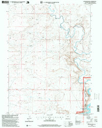
1996 Map of Massacre Hill
USGS Topo · Published 1999About this map
Massacre Hill rises above a landscape defined by significant hydrological and administrative transitions in southwest Wyoming. In the southern portion of the sheet, the waters of Flaming Gorge Reservoir extend into the Ashley National Forest, creating the Flaming Gorge National Recreation Area. This area represents a critical junction where the high desert terrain meets the managed waters of the Green River system.
Find a feature on this map
11 named features on this map. Tap any name to fly to it.
Don’t see what you’re looking for? This feature index may not catch every label — zoom into the map to look around manually.
Map Details
Editions of this 1996 Massacre Hill Map
This is the sole edition of this map. No revisions or reprints were ever made.
Other maps of this area

1954 · Rock Springs
USGS Topo · 1:250,000

1957 · Mc Kinnon Junction
USGS Topo · 1:62,500

1958 · Rock Springs
USGS Topo · 1:250,000

1961 · Little America
USGS Topo · 1:24,000

1961 · Peru
USGS Topo · 1:24,000

1961 · Bryan
USGS Topo · 1:24,000

1962 · Rock Springs
USGS Topo · 1:250,000

1964 · Antelope Knoll NE
USGS Topo · 1:24,000

1964 · Winter Fat Reservoir
USGS Topo · 1:24,000

1966 · Mc Kinnon Junction
USGS Topo · 1:62,500