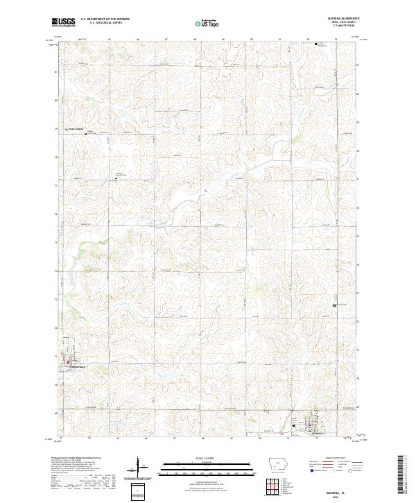
2022 Map of Massena
USGS Topo · Published 2022About this map
Massena and Cumberland anchor this southwestern Iowa landscape, showing the traditional grid-iron street layouts that define local agricultural hubs. The terrain is shaped by the dendritic drainage of Sevenmile Cr, which is fed by numerous named tributaries including Whislers Br, Pettitts Br, and Hoyts Br. These waterways create a rolling topography that breaks the rigid section lines of the Public Land Survey System, which otherwise governs the placement of roads like Lansing Rd and Richland Rd.
Find a feature on this map
49 named features on this map. Tap any name to fly to it.
Don’t see what you’re looking for? This feature index may not catch every label — zoom into the map to look around manually.
Map Details
Editions of this 2022 Massena Map
This is the sole edition of this map. No revisions or reprints were ever made.
Other maps of this area

1954 · Omaha
USGS Topo · 1:250,000

1957 · Omaha
USGS Topo · 1:250,000

1958 · Omaha
USGS Topo · 1:250,000

1971 · Adair South
USGS Topo · 1:24,000

1971 · Anita
USGS Topo · 1:24,000

1971 · Wiota
USGS Topo · 1:24,000

1971 · Anita SW
USGS Topo · 1:24,000

1971 · Massena
USGS Topo · 1:24,000

1971 · Fontanelle SW
USGS Topo · 1:24,000

1980 · Grant
USGS Topo · 1:24,000