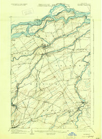
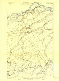
1907 Map of Massena
USGS Topo · Published 1929About this map
St Lawrence River and its complex network of islands and rapids define this border region at the turn of the century. The map illustrates the industrial emergence of Massena, linked by the Massena Power Canal to the river's flow. Large islands like Barnhart Island and Sheek Island dominate the northern channel, bordered by the Cornwall Canal on the Canadian side. This era shows the convergence of multiple rail lines, including the Grand Trunk RR and the Norwood and Rutland RR, which serviced the growing paper and milling centers. Smaller communities such as Massena Springs, Raymondville, and Brasher Falls are depicted along the winding paths of the Raquette River and St Regis River, providing a detailed look at St. Lawrence County before modern hydroelectric projects transformed the river's geography.
Find a feature on this map
52 named features on this map. Tap any name to fly to it.
Don’t see what you’re looking for? This feature index may not catch every label — zoom into the map to look around manually.
Map Details
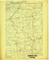
Editions of this 1907 Massena Map
6 editions found
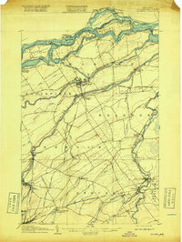
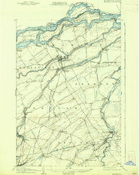

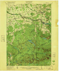
Other maps of this area

1905 · Waddington
USGS Topo · 1:62,500

1906 · Massena
USGS Topo · 1:62,500
1907 · Massena
USGS Topo · 1:62,500

1908 · Potsdam
USGS Topo · 1:62,500

1910 · Canton
USGS Topo · 1:62,500

1911 · Canton
USGS Topo · 1:62,500

1915 · Moira
USGS Topo · 1:62,500
1917 · Moira
USGS Topo · 1:62,500

1919 · Nicholville
USGS Topo · 1:62,500
1921 · Nicholville
USGS Topo · 1:62,500