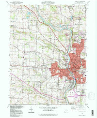
1994 Map of Massillon
USGS Topo · Published 1998About this map
The Tuscarawas River defines the industrial and residential heart of this region, winding through the city of Massillon and its numerous suburban expansions. By the mid-1990s, the area shows a dense network of neighborhoods including Sippo Heights, Kendall Heights, and Amherst Heights, alongside established institutions like the Massillon State Hospital and Washington High Sch. The landscape is a mix of heavy industrial footprints, such as several quarries and a Slag Dump, and preserved natural spaces like the Jackson Bog State Natural Area.
Find a feature on this map
111 named features on this map. Tap any name to fly to it.
Don’t see what you’re looking for? This feature index may not catch every label — zoom into the map to look around manually.
Map Details
Editions of this 1994 Massillon Map
This is the sole edition of this map. No revisions or reprints were ever made.
Other maps of this area

1901 · Massillon
USGS Topo · 1:62,500

1901 · Canton
USGS Topo · 1:62,500

1903 · Massillon
USGS Topo · 1:62,500

1903 · Canton
USGS Topo · 1:62,500

1912 · Dover
USGS Topo · 1:62,500

1914 · Navarre
USGS Topo · 1:62,500

1944 · Navarre
USGS Topo · 1:62,500

1944 · Dover
USGS Topo · 1:62,500

1951 · Canton
USGS Topo · 1:250,000

1951 · Bolivar
USGS Topo · 1:24,000