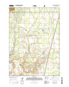
2014 Map of Masten Butte
USGS Topo · Published 2014About this map
Deschutes National Forest dominates this landscape along the border of Deschutes and Klamath counties, where the high desert meets the volcanic terrain of the Masten Butte area. The Little Deschutes River winds through the western portion of the map, supporting a complex network of water management features including the Mayfield Ditch, Walker Basin Canal, and W A Lateral. These irrigation works suggest the historical efforts to manage water in this arid region. To the east, the wide expanse of Long Prairie is drained by the Long Prairie Slough, while a modern transportation corridor is defined by Hwy 97 N and The Dalles-California Hwy. Residential and forest access roads like Wagon Trail Rd and Old Cabin Rd reflect the intersection of public land management and rural development near the turn of the twenty-first century.
Find a feature on this map
44 named features on this map. Tap any name to fly to it.
Don’t see what you’re looking for? This feature index may not catch every label — zoom into the map to look around manually.
Map Details
Editions of this 2014 Masten Butte Map
This is the sole edition of this map. No revisions or reprints were ever made.
Other maps of this area

1930 · Maiden Peak
USGS Topo · 1:125,000

1931 · Newberry Crater
USGS Topo · 1:125,000

1934 · Maiden Peak
USGS Topo · 1:125,000

1935 · Chemult
USGS Topo · 1:96,000

1935 · Newberry Crater
USGS Topo · 1:125,000

1941 · Chemult
USGS Topo · 1:125,000

1955 · Crescent
USGS Topo · 1:250,000

1957 · Crescent
USGS Topo · 1:250,000

1958 · Crescent
USGS Topo · 1:250,000

1963 · La Pine
USGS Topo · 1:24,000