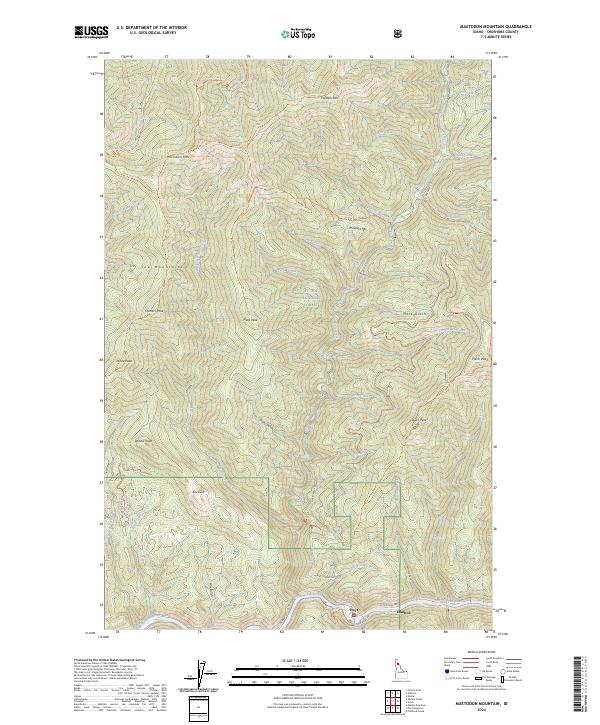
2024 Map of Mastodon Mountain
USGS Topo · Published 2024About this map
The Saint Joe Wild and Scenic River corridor anchors the southern edge of this Idaho landscape, where the small settlements of Hoyt and Ethelton sit along the riverbanks. This area within the St. Joe National Forest is defined by high-elevation peaks and narrow drainage gulches. The terrain is marked by a series of triangulation stations and lookout points, including Dunn Peak Lookout Ohv Tri and Prince Peak Tri, suggesting a history of fire observation and surveying across the St. Joe Mountains. Numerous waterways such as Slate Creek and Prospect Creek carve through the steep topography, feeding eventually into the Saint Joe. A network of forest development roads, including Nat For Dev Rd 225, provides access to these peaks, reflecting the region's management for timber and recreation.
Find a feature on this map
57 named features on this map. Tap any name to fly to it.
Don’t see what you’re looking for? This feature index may not catch every label — zoom into the map to look around manually.
Map Details
Editions of this 2024 Mastodon Mountain Map
This is the sole edition of this map. No revisions or reprints were ever made.
Other maps of this area

1914 · Avery
USGS Topo · 1:125,000

1917 · Avery
USGS Topo · 1:125,000

1955 · Spokane
USGS Topo · 1:250,000

1956 · Wallace
USGS Topo · 1:250,000

1957 · Wallace
USGS Topo · 1:62,500

1957 · Calder
USGS Topo · 1:62,500

1958 · Spokane
USGS Topo · 1:250,000

1960 · Wallace
USGS Topo · 1:250,000

1969 · Marble Mountain
USGS Topo · 1:24,000
1969 · Hoyt Mountain
USGS Topo · 1:24,000