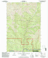
1995 Map of Mastodon Mountain
USGS Topo · Published 1997About this map
The St Joe River corridor defines the southern reaches of this landscape, where a Gaging Station monitors the flow near the mouth of Hoyt Creek. This mid-1990s survey by the U.S. Forest Service captures a high-elevation interior of the St Joe National Forest, a region dominated by steep drainage systems and prominent summits. Resource extraction and forest management are evident through the presence of the Franklin Mine in Slate Creek canyon and the unidentified Prospect X near Prospect Mountain. High points like Dunn Peak, which features the Nud Lookout, and Mastodon Mountain serve as primary landmarks for the Avery Ranger District. The terrain is deeply incised by numerous drainages, including Lumberjack Gulch and Daisy Gulch, illustrating the complex hydrology of the Shoshone County backcountry before the turn of the century.
Find a feature on this map
36 named features on this map. Tap any name to fly to it.
Don’t see what you’re looking for? This feature index may not catch every label — zoom into the map to look around manually.
Map Details
Editions of this 1995 Mastodon Mountain Map
This is the sole edition of this map. No revisions or reprints were ever made.
Other maps of this area

1914 · Avery
USGS Topo · 1:125,000

1917 · Avery
USGS Topo · 1:125,000

1955 · Spokane
USGS Topo · 1:250,000

1956 · Wallace
USGS Topo · 1:250,000

1957 · Wallace
USGS Topo · 1:62,500

1957 · Calder
USGS Topo · 1:62,500

1958 · Spokane
USGS Topo · 1:250,000

1960 · Wallace
USGS Topo · 1:250,000

1969 · Marble Mountain
USGS Topo · 1:24,000
1969 · Hoyt Mountain
USGS Topo · 1:24,000