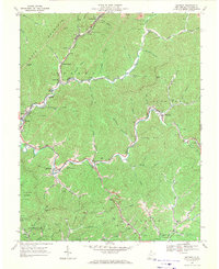
1967 Map of Matheny
USGS Topo · Published 1971About this map
Kopperston and the surrounding mining landscape along Toney Fork anchor this late 1960s study of Wyoming County. The region's industrial character is defined by the Norfolk and Western railroad and support infrastructure like the Compressor Sta and several Strip Mine operations scattered across the hills. Settlements follow the winding course of the Clear Fork and Laurel Fork, connecting Oceana and Hatcher to smaller communities such as Edith and Matheny. Cultural markers of the era include the Drive-in Theater south of Oceana and Hillcrest Memorial Gardens. The topographic detail reveals the intricate drainage patterns of Huff Mountain and the Slab Fork district, where dozens of family-named hollows like Acord Branch and Ralph Branch carved out the living space for local residents between the steep ridges of Baileysville and Center.
Find a feature on this map
58 named features on this map. Tap any name to fly to it.
Don’t see what you’re looking for? This feature index may not catch every label — zoom into the map to look around manually.
Map Details
Editions of this 1967 Matheny Map
2 editions found
Other maps of this area

1891 · Oceana
USGS Topo · 1:125,000

1891 · Raleigh
USGS Topo · 1:125,000

1893 · Oceana
USGS Topo · 1:125,000

1897 · Raleigh
USGS Topo · 1:125,000

1898 · Oceana
USGS Topo · 1:125,000

1902 · Raleigh
USGS Topo · 1:125,000

1910 · Pineville
USGS Topo · 1:48,000

1910 · Bald Knob
USGS Topo · 1:48,000

1911 · Marshes
USGS Topo · 1:48,000

1912 · Mullens
USGS Topo · 1:62,500