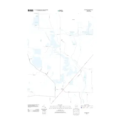
2013 Map of Mather
USGS Topo · Published 2013About this map
The settlement of Mather serves as the central hub of this Jackson County landscape, where Wisconsin's managed water systems define the geography. The region is dominated by an intricate network of reservoirs and flowages, including Kingston Flowage, Beaver Flowage, and Scott Flowage, which reflect the area's history of water management and wildlife habitat preservation. Higher ground is sparsely represented, most notably at Hog Island and near Cem Hill, providing a contrast to the surrounding wetlands and drainage basins.
Find a feature on this map
44 named features on this map. Tap any name to fly to it.
Don’t see what you’re looking for? This feature index may not catch every label — zoom into the map to look around manually.
Map Details
Editions of this 2013 Mather Map
This is the sole edition of this map. No revisions or reprints were ever made.
Other maps of this area

1953 · Eau Claire
USGS Topo · 1:250,000
1957 · Pittsville
USGS Topo · 1:48,000
1957 · City Point
USGS Topo · 1:48,000

1958 · Eau Claire
USGS Topo · 1:250,000
1958 · Necedah
USGS Topo · 1:48,000
1958 · Wyeville
USGS Topo · 1:48,000

1964 · Eau Claire
USGS Topo · 1:250,000
1967 · Pittsville
USGS Topo · 1:62,500
1969 · Cutler
USGS Topo · 1:24,000
1969 · Finley
USGS Topo · 1:24,000