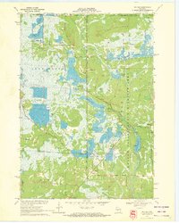
1970 Map of Mather
USGS Topo · Published 1972About this map
Mather serves as a central hub in this landscape of managed wetlands and cranberry production at the Juneau and Monroe county line. The map reveals an intricate hydraulic network essential to the local economy, featuring extensive Cranberry Bog operations and massive water impoundments like the Meadow Valley Flowage and Kingston Flowage. These water bodies are intertwined with the Meadow Valley State Wildlife Area, illustrating a transition toward conservation and recreation during the late 20th century.
Find a feature on this map
45 named features on this map. Tap any name to fly to it.
Don’t see what you’re looking for? This feature index may not catch every label — zoom into the map to look around manually.
Map Details
Editions of this 1970 Mather Map
This is the sole edition of this map. No revisions or reprints were ever made.
Other maps of this area

1953 · Eau Claire
USGS Topo · 1:250,000

1957 · Pittsville
USGS Topo · 1:48,000

1957 · City Point
USGS Topo · 1:48,000

1958 · Eau Claire
USGS Topo · 1:250,000

1958 · Necedah
USGS Topo · 1:48,000

1958 · Wyeville
USGS Topo · 1:48,000

1964 · Eau Claire
USGS Topo · 1:250,000

1967 · Pittsville
USGS Topo · 1:62,500
1969 · Cutler
USGS Topo · 1:24,000
1969 · Finley
USGS Topo · 1:24,000