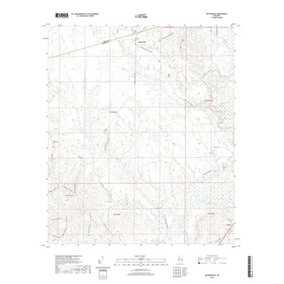
2018 Map of Matherville
USGS Topo · Published 2018About this map
The border of Clarke Co and Wayne Co runs through this rural Mississippi landscape, centered on the historic crossroads of Matherville. This region is defined by a dense network of creek drainages, including the meandering Buckatunna Creek and its many tributaries like Shiloh Cr and Cypress Cr. For genealogists, the map is particularly detailed, pinpointing numerous small family and community burial grounds such as Matherville Cem, Scotch Chapel Cem, and the remote Gandy Cem. The road system, featuring names like Matherville Frost Bridge Rd and Waynesboro Matherville Rd, reflects the area's connectivity between small settlements. To the southeast, the community of Gretna sits near the junction of Old US Hwy 84, illustrating the settlement patterns in this timber and creek-rich portion of the state.
Find a feature on this map
53 named features on this map. Tap any name to fly to it.
Don’t see what you’re looking for? This feature index may not catch every label — zoom into the map to look around manually.
Map Details
Editions of this 2018 Matherville Map
This is the sole edition of this map. No revisions or reprints were ever made.
Other maps of this area

1953 · Hattiesburg
USGS Topo · 1:250,000

1958 · Hattiesburg
USGS Topo · 1:250,000

1964 · Carmichael
USGS Topo · 1:24,000

1964 · Denham
USGS Topo · 1:24,000

1964 · De Soto
USGS Topo · 1:24,000

1964 · Waynesboro
USGS Topo · 1:24,000

1964 · Shubuta
USGS Topo · 1:24,000

1964 · Matherville
USGS Topo · 1:24,000

1974 · Melvin
USGS Topo · 1:24,000

1974 · Isney
USGS Topo · 1:24,000