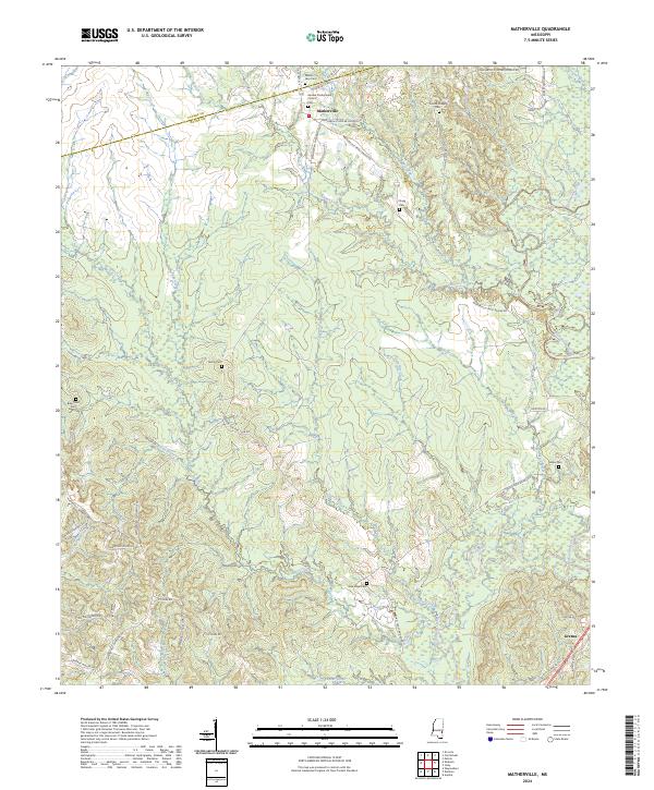
2024 Map of Matherville
USGS Topo · Published 2024About this map
Matherville and the settlement of Gretna anchor this landscape along the border of Clarke and Wayne Counties. The area is defined by a dense network of tributaries including Buckatunna Creek, Shiloh Creek, and Cypress Creek, which carve through the terrain. A notable concentration of cemeteries, such as Mount Levy Cem, Geneva Presbyterian Church Cem, and Scotch Chapel Cem, suggests a long-standing rural community structure tied to family and church grounds. Many of the local roads, such as Waynesboro Matherville Rd and Matherville Frost Bridge Rd, trace historical routes between these points of interest. The southern portion of the map is particularly water-rich, featuring Coldwater Creek and Little Dry Creek, while the presence of the Wayne Hunting Club Rd reflects the local land use and recreational heritage of the Mississippi piney woods.
Find a feature on this map
50 named features on this map. Tap any name to fly to it.
Don’t see what you’re looking for? This feature index may not catch every label — zoom into the map to look around manually.
Map Details
Editions of this 2024 Matherville Map
This is the sole edition of this map. No revisions or reprints were ever made.
Other maps of this area

1953 · Hattiesburg
USGS Topo · 1:250,000

1958 · Hattiesburg
USGS Topo · 1:250,000

1964 · Carmichael
USGS Topo · 1:24,000

1964 · Denham
USGS Topo · 1:24,000

1964 · De Soto
USGS Topo · 1:24,000

1964 · Waynesboro
USGS Topo · 1:24,000

1964 · Shubuta
USGS Topo · 1:24,000

1964 · Matherville
USGS Topo · 1:24,000

1974 · Melvin
USGS Topo · 1:24,000

1974 · Isney
USGS Topo · 1:24,000