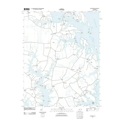
2011 Map of Mathews
USGS Topo · Published 2011About this map
The Tidewater landscape of Mathews County is defined by its deep maritime heritage and intricate shoreline along the Chesapeake Bay. Centered on the community of Mathews, the survey illustrates a complex geography of necks and points, where the East River and North River meet the bay. This era reveals a well-established network of small landings and wharves, such as Fitchett Wharf Landing and Williams Wharf, which were once vital for local commerce and river transport.
Find a feature on this map
115 named features on this map. Tap any name to fly to it.
Don’t see what you’re looking for? This feature index may not catch every label — zoom into the map to look around manually.
Map Details
Editions of this 2011 Mathews Map
This is the sole edition of this map. No revisions or reprints were ever made.
Other maps of this area

1916 · Kilmarnock
USGS Topo · 1:48,000

1916 · Mathews
USGS Topo · 1:62,500

1917 · Kilmarnock
USGS Topo · 1:62,500

1917 · Mathews
USGS Topo · 1:62,500

1942 · Kilmarnock
USGS Topo · 1:62,500

1943 · Richmond
USGS Topo · 1:250,000

1948 · Ware Neck
USGS Topo · 1:24,000

1948 · Achilles
USGS Topo · 1:24,000

1948 · Deltaville
USGS Topo · 1:24,000

1948 · New Point Comfort
USGS Topo · 1:24,000