Loading...
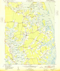
Loading map...1917 Map of Mathews
USGS Topo · Published 1923About this map
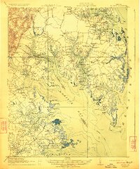
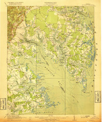
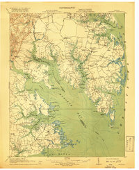
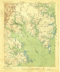
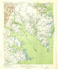
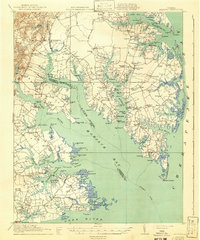
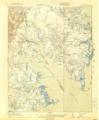
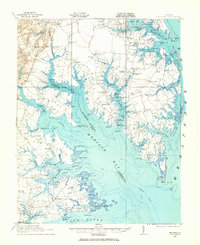
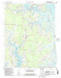
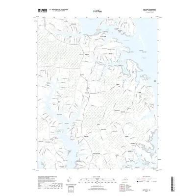
Mobjack Bay and the intricate Chesapeake shoreline dominate this 1916 survey, revealing a landscape defined by its deep reliance on water transport. The map documents the Mathews peninsula just before the modern road era, when steamboats were the primary link to the outside world. Numerous landings such as Callis Wharf, Roanes Wharf, and Hockley Wharf punctuate the creeks and rivers, serving as vital economic hubs for local agriculture and fishing.
Find a feature on this map
119 named features on this map. Tap any name to fly to it.
Don’t see what you’re looking for? This feature index may not catch every label — zoom into the map to look around manually.
Map Details
Date Portrayed1917
Date Published1923
PublisherU.S. Geological Survey
Map TypeTopographic
Scale1:62,500
Physical Dimensions16.42 x 19.73 inches
Editions of this 1917 Mathews Map
7 editions found
Historical Maps of Gloucester Point Through Time
9 maps found

Featured Locations
Source Details
SourceU.S. Geological Survey
CopyrightPublic Domain