
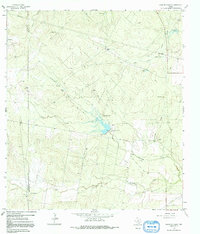
1925 Map of Mathis No. 3
USGS Topo · Published 1925This historical map portrays the area of Mathis No. 3 in 1925, primarily covering Jim Wells County as well as portions of Live Oak County and San Patricio County. Featuring a scale of 1:48000, this map provides a highly detailed snapshot of the terrain, roads, buildings, counties, and historical landmarks in the Mathis No. 3 region at the time. Published in 1925, it is the sole known edition of this map.
Find a feature on this map
21 named features on this map. Tap any name to fly to it.
Don’t see what you’re looking for? This feature index may not catch every label — zoom into the map to look around manually.
Map Details
Editions of this 1925 Mathis No. 3 Map
This is the sole edition of this map. No revisions or reprints were ever made.
Historical Maps of Sandia Through Time
12 maps found
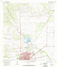
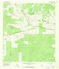
1925 Mathis No. 3
Jim Wells County, TX
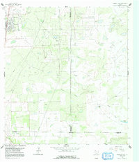
1963 Alice North
Jim Wells County, TX

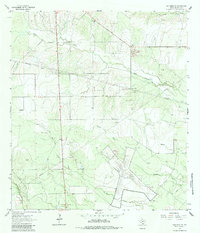
1963 Alice South
Jim Wells County, TX
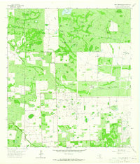
1963 Ben Bolt NW
Jim Wells County, TX
1963 Ben Bolt SE
Jim Wells County, TX
1963 Ella
Jim Wells County, TX
1963 Palito Blanco
Jim Wells County, TX
1963 Premont East
Jim Wells County, TX

1963 Premont West
Jim Wells County, TX
1963 San Diego NE
Jim Wells County, TX
1963 Seeligson Ranch
Jim Wells County, TX
1963 Shaeffer Ranch
Jim Wells County, TX
Featured Locations
- Hodges Addition Colonia, TX
- Casa Blanca, TX
- John L Norris Colonia, TX
- Norris Tract Number 2 Colonia, TX
- Lake City, TX