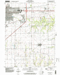
1998 Map of Mattoon East
USGS Topo · Published 2002About this map
The Mattoon corporate boundary and the western edge of Charleston define the northern corridor of this landscape, where the Coles County Memorial Airport and a nostalgic Drive-In Theater sit near the transition to rural township lands. Moving south from the urban developments, the map reveals the agricultural character of Lafayette and Pleasant Grove townships. This area is defined by the dendritic patterns of Kickapoo Creek and Sweetwater Creek, which carve through the till plain.
Find a feature on this map
24 named features on this map. Tap any name to fly to it.
Don’t see what you’re looking for? This feature index may not catch every label — zoom into the map to look around manually.
Map Details
Editions of this 1998 Mattoon East Map
This is the sole edition of this map. No revisions or reprints were ever made.
Other maps of this area

1933 · Toledo
USGS Topo · 1:62,500

1934 · Mattoon
USGS Topo · 1:62,500

1935 · Arcola
USGS Topo · 1:48,000

1936 · Oakland
USGS Topo · 1:48,000

1937 · Mattoon
USGS Topo · 1:62,500

1938 · Toledo
USGS Topo · 1:62,500

1940 · Arcola
USGS Topo · 1:62,500

1942 · Oakland
USGS Topo · 1:62,500

1958 · Decatur
USGS Topo · 1:250,000

1961 · Decatur
USGS Topo · 1:250,000