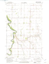
1974 Map of Mattson
USGS Topo · Published 1976About this map
The Red River defines the border between Minnesota and North Dakota on this mid-1970s survey, showing the complex meanders that separate Lincoln and North Red River townships. This agricultural landscape in Kittson County is shaped by an extensive water management system, including Ditch No 21, Ditch No 29, and Ditch No 9, which channel water toward the primary river system. The small settlement of Mattson sits at the heart of the quadrangle, serving as a focal point for the surrounding rural communities of Skane and Svea. Local history and genealogy interest is anchored by the Tabitha Ch and its associated Cem, along with the Red River Ch further south near the South Red River junction. The placement of the Townhall in Skane provides a clear indication of local civic organization during this era.
Find a feature on this map
19 named features on this map. Tap any name to fly to it.
Don’t see what you’re looking for? This feature index may not catch every label — zoom into the map to look around manually.
Map Details
Editions of this 1974 Mattson Map
This is the sole edition of this map. No revisions or reprints were ever made.
Other maps of this area

1939 · Drayton
USGS Topo · 1:62,500

1939 · Pembina
USGS Topo · 1:62,500

1939 · Kennedy
USGS Topo · 1:62,500

1941 · Kennedy
USGS Topo · 1:62,500

1941 · Drayton
USGS Topo · 1:62,500

1941 · Hallock
USGS Topo · 1:62,500

1941 · Pembina
USGS Topo · 1:62,500

1952 · Thief River Falls
USGS Topo · 1:250,000

1956 · Thief River Falls
USGS Topo · 1:250,000

1957 · Thief River Falls
USGS Topo · 1:250,000