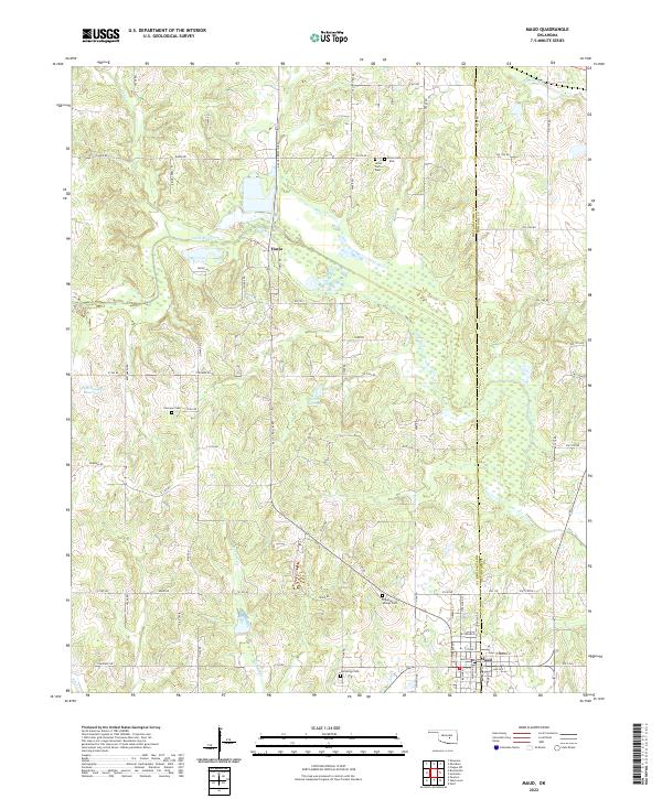
2022 Map of Maud
USGS Topo · Published 2022About this map
Maud sits at the intersection of the Pottawatomie Co Seminole Co boundary, serving as a focal point for this landscape of creek drainages and small-scale water management. The town's grid, featuring streets like Main St and Broadway St, contrasts with the dispersed rural character of the surrounding townships. North of town, the settlement of Harjo is positioned near the Little River, which meanders through the center of the region. The map reveals a high density of rural burial grounds, including the split Union Cem - West and Union Cem - East, alongside Fairview Cem, Cummings Cem, and Dripping Springs Cem. These sites, along with numerous unnamed reservoirs and the larger J E McSpadden Reservoir, reflect a landscape deeply shaped by agricultural persistence and local family history.
Find a feature on this map
80 named features on this map. Tap any name to fly to it.
Don’t see what you’re looking for? This feature index may not catch every label — zoom into the map to look around manually.
Map Details
Editions of this 2022 Maud Map
This is the sole edition of this map. No revisions or reprints were ever made.
Other maps of this area

1896 · Seminole and Prague
USGS Topo · 1:125,000

1907 · Maud
USGS Topo · 1:62,500

1908 · Maud
USGS Topo · 1:62,500

1909 · Shawnee
USGS Topo · 1:62,500

1954 · Oklahoma City
USGS Topo · 1:250,000

1957 · Oklahoma City
USGS Topo · 1:250,000
1958 · Pearson
USGS Topo · 1:24,000

1963 · Oklahoma City
USGS Topo · 1:250,000

1967 · Prague SW
USGS Topo · 1:24,000
1967 · Shawnee
USGS Topo · 1:24,000