
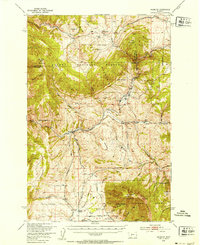
1949 Map of Maudlow
USGS Topo · Published 1954About this map
Maudlow sits at the convergence of rugged Montana mountain ranges, serving as a focal point for the ranching and railroad activity of the late 1940s. The landscape is defined by the massive Belt Mountains and the Bridger Range, with the Chicago Milwaukee and Northern Pacific railroads carving essential transportation routes through the steep drainages. Local life is anchored by family operations such as the Hatfield Ranch and Morgan Ranch, supported by a network of rural schoolhouses including Francis School, Josephine School, and Durham School. The presence of the Morgan Cemetery and the St Paul and Pacific route highlights the deep-rooted settlement history and infrastructure needed to sustain these remote communities. The terrain transitions from the high peaks of Sixmile Mountain and Table Mountain to the deep incisions of Sixteenmile Creek and Painted Canyon.
Find a feature on this map
65 named features on this map. Tap any name to fly to it.
Don’t see what you’re looking for? This feature index may not catch every label — zoom into the map to look around manually.
Map Details
Editions of this 1949 Maudlow Map
4 editions found
Other maps of this area

1886 · Fort Logan
USGS Topo · 1:250,000

1886 · Little Belt Mts.
USGS Topo · 1:250,000

1888 · Three Forks
USGS Topo · 1:250,000

1891 · Livingston
USGS Topo · 1:250,000

1893 · Livingston
USGS Topo · 1:250,000

1894 · Three Forks
USGS Topo · 1:250,000

1894 · Little Belt Mts.
USGS Topo · 1:250,000

1895 · Three Forks
USGS Topo · 1:250,000

1897 · Little Belt Mts.
USGS Topo · 1:250,000

1898 · Little Belt Mts.
USGS Topo · 1:250,000