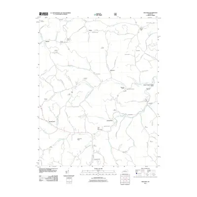
2011 Map of Maulden
USGS Topo · Published 2011About this map
Sexton Creek and its many winding tributaries, including Little Sexton Creek and Jims Branch, carve through this section of Owsley County, defining the local settlement patterns and transportation routes. The landscape is characterized by narrow hollows and ridges like Silvermine Ridge and Cope Hollow, where small communities and family farmsteads established their roots. Historic infrastructure is evident in the presence of Wilson's Mill and the Maulden P O, alongside the Sexton Creek Post Office. The map serves as a detailed record of local genealogy, documenting dozens of burial sites such as the Boggs Flat Cemeteries, Cradlebow Cemetery, and the Smith Cemetery. Small hamlets like Island City, Chestnutburg, and Maulden are connected by a network of rural roads that follow the natural topography, illustrating the enduring relationship between the community and the Appalachian terrain.
Find a feature on this map
103 named features on this map. Tap any name to fly to it.
Don’t see what you’re looking for? This feature index may not catch every label — zoom into the map to look around manually.
Map Details
Editions of this 2011 Maulden Map
This is the sole edition of this map. No revisions or reprints were ever made.
Other maps of this area

1891 · Manchester
USGS Topo · 1:125,000

1952 · Portersburg
USGS Topo · 1:24,000

1952 · Manchester
USGS Topo · 1:24,000

1953 · Mc Kee
USGS Topo · 1:24,000

1953 · Oneida
USGS Topo · 1:24,000

1953 · Tyner
USGS Topo · 1:24,000

1953 · Booneville
USGS Topo · 1:24,000

1953 · Sturgeon
USGS Topo · 1:24,000

1954 · Barcreek
USGS Topo · 1:24,000

1954 · Maulden
USGS Topo · 1:24,000