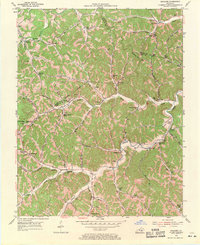
1954 Map of Maulden
USGS Topo · Published 1971About this map
Deep within the hollows of Clay and Owsley Counties, this mid-century landscape is defined by an intricate network of waterways like Sturgeon Creek and Sexton Creek. The settlement pattern follows the drainage, with tiny communities and post offices such as Maulden PO and Island City serving as local hubs. The topographic detail reveals a culture built around rural education and faith, evidenced by the numerous small institutions such as Silvermine Sch and Mt Gilead Ch that dot the ridges and creek banks.
Find a feature on this map
96 named features on this map. Tap any name to fly to it.
Don’t see what you’re looking for? This feature index may not catch every label — zoom into the map to look around manually.
Map Details
Editions of this 1954 Maulden Map
2 editions found
Other maps of this area

1891 · Manchester
USGS Topo · 1:125,000

1952 · Portersburg
USGS Topo · 1:24,000

1952 · Manchester
USGS Topo · 1:24,000

1953 · Mc Kee
USGS Topo · 1:24,000

1953 · Oneida
USGS Topo · 1:24,000

1953 · Tyner
USGS Topo · 1:24,000

1953 · Booneville
USGS Topo · 1:24,000

1953 · Sturgeon
USGS Topo · 1:24,000

1954 · Barcreek
USGS Topo · 1:24,000

1954 · Maulden
USGS Topo · 1:24,000