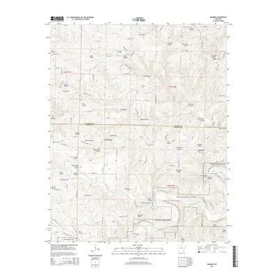
2014 Map of Maumee
USGS Topo · Published 2014About this map
Buffalo National River dominates the southeastern quadrant of this terrain, following the winding course of the Buffalo River. The landscape is deeply carved by a dense network of drainages, including Barren Fork, Tomahawk Cr, and Water Cr, which create the characteristic Ozark topography of high ridges and narrow hollows. The settlement pattern is largely dispersed, with small communities such as Maumee, Tomahawk, Freck, and Caney situated along the higher ground or tucked into accessible valleys. Local history is anchored by sites like Tomahawk Church and several family burial grounds, including Burns Cem and Caney Cem. Evidence of past resource extraction is visible in the naming of Copper Mine Hollow and the Copper Mine itself, reflecting the area's mineral prospects. The boundary between Marion and Searcy counties bisects the map, illustrating how these natural landforms influenced administrative divisions.
Find a feature on this map
124 named features on this map. Tap any name to fly to it.
Don’t see what you’re looking for? This feature index may not catch every label — zoom into the map to look around manually.
Map Details
Editions of this 2014 Maumee Map
This is the sole edition of this map. No revisions or reprints were ever made.
Other maps of this area

1892 · Marshall
USGS Topo · 1:125,000

1893 · Yellville
USGS Topo · 1:125,000

1894 · Marshall
USGS Topo · 1:125,000

1901 · Marshall
USGS Topo · 1:125,000

1903 · Yellville
USGS Topo · 1:125,000

1905 · Yellville
USGS Topo · 1:125,000

1929 · Yellville
USGS Topo · 1:125,000

1939 · Snowball
USGS Topo · 1:62,500

1941 · Snowball
USGS Topo · 1:62,500

1942 · Snowball
USGS Topo · 1:62,500