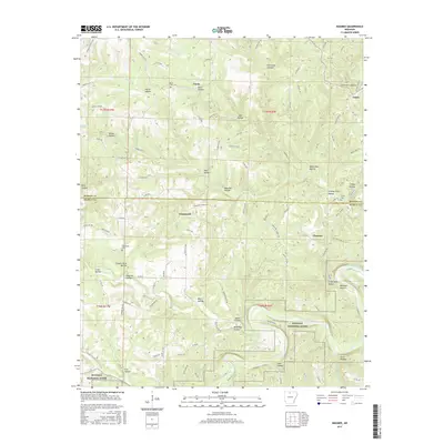
2017 Map of Maumee
USGS Topo · Published 2017About this map
Buffalo National River anchors the southern portion of this landscape, where the waterway carves through a dense network of named hollows. This 2017 survey reveals the quiet rural character of the border between Marion and Searcy Counties, centered around the small settlements of Maumee, Tomahawk, Freck, and Caney. The terrain is deeply incised by drainages such as Barren Fork and Tomahawk Cr, with local history preserved in family-named sites like Granny Price Hollow and Osborne Hollow. Local genealogy is well-supported by the location of several historic burial grounds, including Tomahawk Cem, Caney Cem, and Burns Cem. Remnants of past industry are suggested by Copper Mine Hollow, while the complex topography of the Ozark foothills is reflected in features like Barren Fork Gulf Hollow and Elm Cave Hollow.
Find a feature on this map
117 named features on this map. Tap any name to fly to it.
Don’t see what you’re looking for? This feature index may not catch every label — zoom into the map to look around manually.
Map Details
Editions of this 2017 Maumee Map
This is the sole edition of this map. No revisions or reprints were ever made.
Other maps of this area

1892 · Marshall
USGS Topo · 1:125,000

1893 · Yellville
USGS Topo · 1:125,000

1894 · Marshall
USGS Topo · 1:125,000

1901 · Marshall
USGS Topo · 1:125,000

1903 · Yellville
USGS Topo · 1:125,000

1905 · Yellville
USGS Topo · 1:125,000

1929 · Yellville
USGS Topo · 1:125,000

1939 · Snowball
USGS Topo · 1:62,500

1941 · Snowball
USGS Topo · 1:62,500

1942 · Snowball
USGS Topo · 1:62,500