
1956 Map of Mauna Kea
USGS Topo · Published 1957About this map
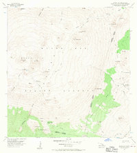
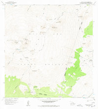
Mauna Kea dominates this mid-century topographic study, which captures the volcanic landscape of the island of Hawaii in detail. The map centers on the high-altitude summit, including Lake Waiau and the Keanakakoi (Ancient Quarry), revealing the geological and cultural significance of the mountain. Human presence in this high-elevation environment is represented by the Hale Pohaku Ranger Station and the Kahinahina Forest Cabin, marking the outposts for forest and land management within the Mauna Kea Forest Reserve. Numerous cinder cones, or pu'u, such as Puu Makanaka and Puu Poliahu, punctuate the terrain, while the headwaters of the Wailuku River and deep drainage features like Waikahalulu Gulch illustrate the hydrologic patterns of the windward and leeward slopes.
Find a feature on this map
42 named features on this map. Tap any name to fly to it.
Don’t see what you’re looking for? This feature index may not catch every label — zoom into the map to look around manually.
Map Details
Editions of this 1956 Mauna Kea Map
3 editions found
Other maps of this area

1927 · Kaohe
USGS Topo · 1:62,500

1930 · Humuula
USGS Topo · 1:62,500

1930 · Kaohe
USGS Topo · 1:62,500

1954 · Hawaii North
USGS Topo · 1:250,000

1956 · Puu Oo
USGS Topo · 1:24,000

1956 · Pua Akala
USGS Topo · 1:24,000

1956 · Puu Koli
USGS Topo · 1:24,000

1956 · Keanakolu
USGS Topo · 1:24,000

1956 · Upper Piihonua
USGS Topo · 1:24,000

1956 · Makahalau
USGS Topo · 1:24,000