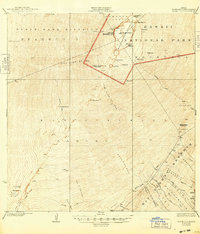
1928 Map of Mauna Loa
USGS Topo · Published 1948About this map
Mauna Loa dominates this high-altitude survey, showcasing the volcanic activity and geologic history of the central Big Island during the mid-1920s. The summit is defined by the massive Mokuaweowe Crater, surrounded by distinct historical scarring including the Lava Flow of 1851 and the more recent Lava Flow of 1926. Portions of the summit fall within the early boundaries of Hawaii National Park, while the southern slopes descend into the dense Kau Forest Reserve. This map provides a critical record of the landscape before later 20th-century eruptions further altered the topography. Volcanologists and historians can trace several human and natural landmarks, from the Ancient Trail and Menzies Trail to the subterranean Umi Caverns. Notable infrastructure includes the Noguchi Tunnels and various named waterholes, reflecting the difficulty of water management in this porous volcanic environment.
Find a feature on this map
52 named features on this map. Tap any name to fly to it.
Don’t see what you’re looking for? This feature index may not catch every label — zoom into the map to look around manually.
Map Details
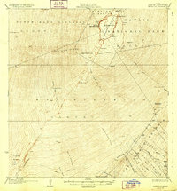
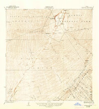
Editions of this 1928 Mauna Loa Map
4 editions found
Other maps of this area

1921 · Kilauea
USGS Topo · 1:62,500

1923 · Pahala
USGS Topo · 1:62,500

1924 · Kilauea
USGS Topo · 1:62,500

1924 · Honuapo
USGS Topo · 1:62,500

1927 · Kaohe
USGS Topo · 1:62,500

1928 · Kailua
USGS Topo · 1:62,500

1928 · Mauna Loa
USGS Topo · 1:62,500

1928 · Hoopuloa
USGS Topo · 1:62,500

1930 · Humuula
USGS Topo · 1:62,500

1930 · Kaohe
USGS Topo · 1:62,500