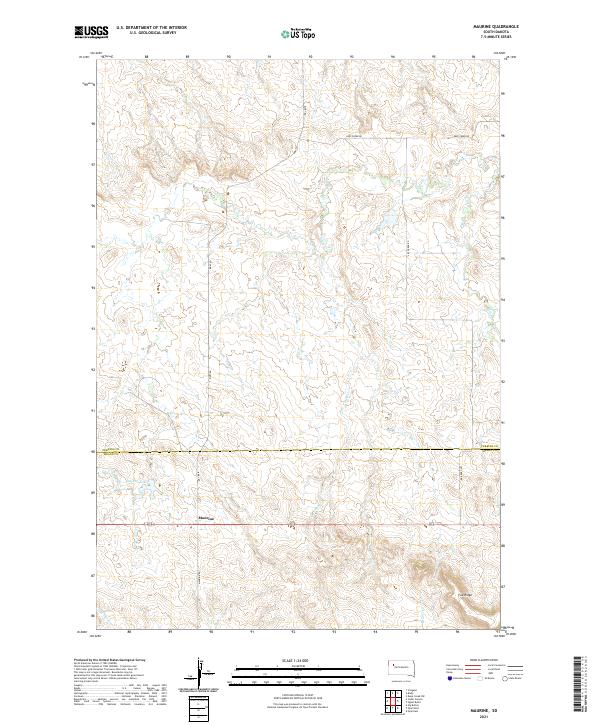
2021 Map of Maurine
USGS Topo · Published 2021About this map
Maurine serves as a central landmark in this portion of the High Plains, situated at the intersection of Maurine Rd and Bixby Rd. The landscape is defined by the subtle drainage networks of Deep Cr and Lilly Cr, which carve through the open country. To the west of the settlement lies Maurine Lake, a notable water feature in an otherwise dry, prairie environment. The southern portion of the map transitions toward Fox Ridge, where the terrain begins to shift near the headwaters of Beaver Cr and E Br Pine Cr. This survey illustrates the sparse, ranch-oriented settlement pattern of the region, where life is organized around long section roads and intermittent watercourses. The boundary line between Perkins Co and Meade Co runs east-to-west, bisecting the quadrangle and marking a significant administrative division in this rural landscape.
Find a feature on this map
16 named features on this map. Tap any name to fly to it.
Don’t see what you’re looking for? This feature index may not catch every label — zoom into the map to look around manually.
Map Details
Editions of this 2021 Maurine Map
This is the sole edition of this map. No revisions or reprints were ever made.
Other maps of this area

1951 · Cedar Canyon
USGS Topo · 1:24,000

1951 · Maurine
USGS Topo · 1:24,000

1951 · Imogene
USGS Topo · 1:24,000

1951 · Deep Creek NW
USGS Topo · 1:24,000

1951 · Bixby
USGS Topo · 1:24,000

1952 · Signal Butte
USGS Topo · 1:24,000

1953 · Rapid City
USGS Topo · 1:250,000

1954 · Lemmon
USGS Topo · 1:250,000

1957 · Lemmon
USGS Topo · 1:250,000

1957 · Rapid City
USGS Topo · 1:250,000