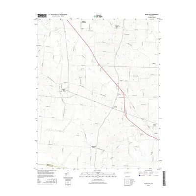
2016 Map of Maury City
USGS Topo · Published 2016About this map
Maury City and Johnsons Grove anchor this portion of West Tennessee, where agricultural fields are bisected by an intricate network of local roads and small creeks. The landscape is defined by its rural heritage, with small crossroads such as Crockett Mills and Brims Corner serving as historic hubs for the surrounding farmsteads. Tributaries including Pond Cr, Tucker Cr, and Black Cr wind through the terrain, illustrating the natural drainage patterns that have shaped land use in this part of Crockett County.
Find a feature on this map
96 named features on this map. Tap any name to fly to it.
Don’t see what you’re looking for? This feature index may not catch every label — zoom into the map to look around manually.
Map Details
Editions of this 2016 Maury City Map
This is the sole edition of this map. No revisions or reprints were ever made.
Other maps of this area

1939 · Halls
USGS Topo · 1:62,500

1952 · Bonicord
USGS Topo · 1:24,000

1952 · Chestnut Bluff
USGS Topo · 1:24,000

1956 · Blytheville
USGS Topo · 1:250,000

1959 · Blytheville
USGS Topo · 1:250,000

1959 · Bells
USGS Topo · 1:24,000

1961 · Jones
USGS Topo · 1:24,000

1961 · Halls
USGS Topo · 1:62,500
1964 · Tibbs
USGS Topo · 1:24,000
1964 · Maury City
USGS Topo · 1:24,000