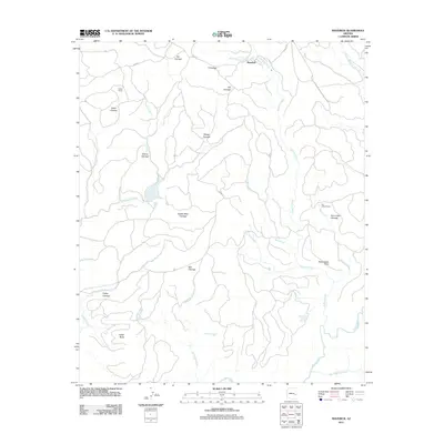
2011 Map of Maverick
USGS Topo · Published 2011About this map
Maverick and several remote ranching outposts define this high-elevation landscape of the White Mountain Apache Reservation. The geography is characterized by an extensive system of cienegas—high-altitude wet meadows—that serve as vital water sources and landmarks. Named features such as Hawks Nest Cienega, Sheep Cienega, and Willow Cienega are interspersed between the rugged drainages of Tonto Creek and Pacheta Creek.
Find a feature on this map
35 named features on this map. Tap any name to fly to it.
Don’t see what you’re looking for? This feature index may not catch every label — zoom into the map to look around manually.
Map Details
Editions of this 2011 Maverick Map
This is the sole edition of this map. No revisions or reprints were ever made.
Other maps of this area

1922 · Nutrioso
USGS Topo · 1:125,000

1954 · Clifton
USGS Topo · 1:250,000

1957 · Clifton
USGS Topo · 1:250,000

1958 · Clifton
USGS Topo · 1:250,000

1958 · Hannagan Meadow
USGS Topo · 1:62,500

1958 · Big Lake
USGS Topo · 1:62,500

1962 · Clifton
USGS Topo · 1:250,000

1967 · Marshall Butte
USGS Topo · 1:24,000

1967 · Freezeout Mountain
USGS Topo · 1:24,000
1967 · Maverick SW
USGS Topo · 1:24,000