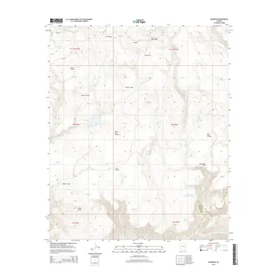
2014 Map of Maverick
USGS Topo · Published 2014About this map
Maverick sits at the heart of this high-elevation landscape, where the headwaters of the Black River and numerous perennial wetlands, or cienegas, dominate the drainage patterns. The network of mountain meadows including Willow Cienega, Paddy Cienega, and Bee Cienega suggests a land historically utilized for seasonal grazing and water management. High points like Paddy Butte and Rattlesnake Point provide topographic relief above the deeply carved drainages of Pacheta Cr and McDonald Cr.
Find a feature on this map
44 named features on this map. Tap any name to fly to it.
Don’t see what you’re looking for? This feature index may not catch every label — zoom into the map to look around manually.
Map Details
Editions of this 2014 Maverick Map
This is the sole edition of this map. No revisions or reprints were ever made.
Other maps of this area

1922 · Nutrioso
USGS Topo · 1:125,000

1954 · Clifton
USGS Topo · 1:250,000

1957 · Clifton
USGS Topo · 1:250,000

1958 · Clifton
USGS Topo · 1:250,000

1958 · Hannagan Meadow
USGS Topo · 1:62,500

1958 · Big Lake
USGS Topo · 1:62,500

1962 · Clifton
USGS Topo · 1:250,000

1967 · Marshall Butte
USGS Topo · 1:24,000

1967 · Freezeout Mountain
USGS Topo · 1:24,000
1967 · Maverick SW
USGS Topo · 1:24,000