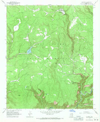
1967 Map of Maverick
USGS Topo · Published 1971About this map
Maverick serves as a central point in this high-altitude landscape within the Fort Apache Indian Reservation, where the terrain is defined by a dense network of mountain springs and cienegas. Water sources such as Elk Cienega, Willow Cienega, and Bee Cienega dot the forested slopes, feeding into larger drainage systems like Pacheta Creek and Tonto Creek. The map documents a specific moment in the mid-1960s where land use is characterized by recreational areas around Tonto Lake and isolated ranching outposts like the Pair o'Dice Ranch. To the south, the terrain drops toward the Black River, which marks the boundary with the San Carlos Indian Reservation. This survey captures the specialized water management infrastructure of the era, including a Gaging Station and various tanks like Salt House Tank and McDonald Tank, reflecting the critical importance of water resources in this part of Arizona.
Find a feature on this map
37 named features on this map. Tap any name to fly to it.
Don’t see what you’re looking for? This feature index may not catch every label — zoom into the map to look around manually.
Map Details
Editions of this 1967 Maverick Map
This is the sole edition of this map. No revisions or reprints were ever made.
Other maps of this area

1922 · Nutrioso
USGS Topo · 1:125,000

1954 · Clifton
USGS Topo · 1:250,000

1957 · Clifton
USGS Topo · 1:250,000

1958 · Clifton
USGS Topo · 1:250,000

1958 · Hannagan Meadow
USGS Topo · 1:62,500

1958 · Big Lake
USGS Topo · 1:62,500

1962 · Clifton
USGS Topo · 1:250,000

1967 · Marshall Butte
USGS Topo · 1:24,000

1967 · Freezeout Mountain
USGS Topo · 1:24,000
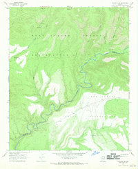
1967 · Maverick SW
USGS Topo · 1:24,000