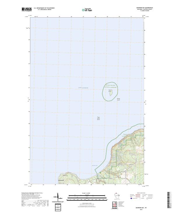
2023 Map of Mawikwe Bay
USGS Topo · Published 2023About this map
Lake Superior borders the northern reaches of the Bayfield Peninsula, where the water meets a landscape defined by conservation and remote coastline. This 2023 survey highlights the protected environments of the Apostle Islands National Lakeshore and the Gaylord Nelson Wilderness, specifically centering on the solitary Eagle Island and its surrounding Eagle Island Shoals. The small settlement of Cornucopia sits on the western edge of the map, serving as a gateway to the area's maritime features. Inland, the terrain is marked by a network of rural roads such as McCutcheon Rd and Menard Rd, while the shoreline is carved into distinct points and bays. Mawikwe Bay and the drainage of Saxine Creek illustrate the hydrologic character of the peninsula, which is further explored by the Sea Caves Trl along the jagged coast near Siskiwit Point.
Find a feature on this map
25 named features on this map. Tap any name to fly to it.
Don’t see what you’re looking for? This feature index may not catch every label — zoom into the map to look around manually.
Map Details
Editions of this 2023 Mawikwe Bay Map
This is the sole edition of this map. No revisions or reprints were ever made.
Other maps of this area

1941 · Bayfield
USGS Topo · 1:48,000

1944 · Cornucopia
USGS Topo · 1:48,000

1946 · Cornucopia
USGS Topo · 1:48,000

1946 · Bayfield
USGS Topo · 1:48,000

1953 · Ashland
USGS Topo · 1:250,000

1954 · Two Harbors
USGS Topo · 1:250,000

1957 · Two Harbors
USGS Topo · 1:250,000

1958 · Ashland
USGS Topo · 1:250,000

1958 · Two Harbors
USGS Topo · 1:250,000

1964 · Two Harbors
USGS Topo · 1:250,000