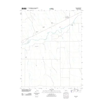
2011 Map of Max
USGS Topo · Published 2011About this map
The Republican River dominates the upper half of this Nebraska-Kansas border region, carving a wide valley that defines the local geography. North of the river, the village of Max serves as a small population center, anchored by the Max Post Office and connected to the surrounding tablelands via Max-Wauneta Rd and Bent St. The landscape south of the river is deeply dissected by numerous drainage features, including Vogley Canyon, Cheyenne Canyon, and the extensive Jones Canyon Creek system. This pattern of drainage reflects the erosion of the high plains, where intermittent streams have cut sharp ravines like Blackwater Canyon and Hickman Canyon into the terrain. For genealogists, the Max Cemetery provides a specific point of interest overlooking the river valley, while the grid of Dundy Co Rd and Road 34 shows the persistent agricultural layout of the county.
Find a feature on this map
15 named features on this map. Tap any name to fly to it.
Don’t see what you’re looking for? This feature index may not catch every label — zoom into the map to look around manually.
Map Details
Editions of this 2011 Max Map
This is the sole edition of this map. No revisions or reprints were ever made.
Other maps of this area

1950 · Mc Donald
USGS Topo · 1:62,500

1951 · Bird City North
USGS Topo · 1:62,500

1951 · Mc Donald
USGS Topo · 1:62,500

1954 · McCook
USGS Topo · 1:250,000

1954 · Goodland
USGS Topo · 1:250,000

1956 · Goodland
USGS Topo · 1:250,000

1957 · McCook
USGS Topo · 1:250,000

1957 · Goodland
USGS Topo · 1:250,000

1958 · McCook
USGS Topo · 1:250,000

1961 · Benkelman
USGS Topo · 1:24,000