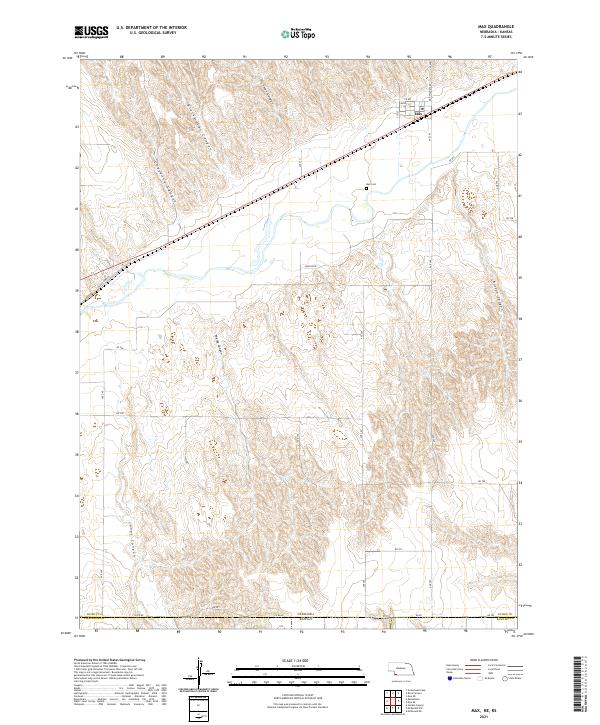
2021 Map of Max
USGS Topo · Published 2021About this map
The settlement of Max sits at the intersection of rural transit and the dissected plains of southwest Nebraska. This modern topographic record illustrates a landscape defined by dramatic drainage patterns, where significant topographical depressions such as Hickman Canyon, Blackwater Canyon, and Cheyenne Canyon carve through the high plains toward the Republican River valley. For genealogists and local historians, the Max Cem serves as a primary landmark for the community, while the network of section-line roads like Max Wauneta Rd and historical routes such as Old US Hwy 34 reveal the enduring framework of the region's agricultural transport. The map also documents the state boundary where Nebraska and Kansas meet, alongside the southern reaches of Vogley Canyon and Boston Canyon, providing a comprehensive look at the area's physical geography.
Find a feature on this map
34 named features on this map. Tap any name to fly to it.
Don’t see what you’re looking for? This feature index may not catch every label — zoom into the map to look around manually.
Map Details
Editions of this 2021 Max Map
This is the sole edition of this map. No revisions or reprints were ever made.
Other maps of this area

1950 · Mc Donald
USGS Topo · 1:62,500

1951 · Bird City North
USGS Topo · 1:62,500

1951 · Mc Donald
USGS Topo · 1:62,500

1954 · McCook
USGS Topo · 1:250,000

1954 · Goodland
USGS Topo · 1:250,000

1956 · Goodland
USGS Topo · 1:250,000

1957 · McCook
USGS Topo · 1:250,000

1957 · Goodland
USGS Topo · 1:250,000

1958 · McCook
USGS Topo · 1:250,000

1961 · Benkelman
USGS Topo · 1:24,000