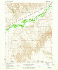
1962 Map of Max
USGS Topo · Published 1964About this map
The Republican River valley forms the centerpiece of this western Nebraska landscape, where the Chicago Burlington and railroad parallels the water's edge. The small settlement of Max serves as the primary local hub, located near the Max Cem and a prominent Radio Tower. The terrain is defined by a series of dramatic drainages including Vogley Canyon, Hickman Canyon, and Boston Canyon, which cut through the high plains toward the river.
Find a feature on this map
26 named features on this map. Tap any name to fly to it.
Don’t see what you’re looking for? This feature index may not catch every label — zoom into the map to look around manually.
Map Details
Editions of this 1962 Max Map
This is the sole edition of this map. No revisions or reprints were ever made.
Other maps of this area

1950 · Mc Donald
USGS Topo · 1:62,500

1951 · Bird City North
USGS Topo · 1:62,500

1951 · Mc Donald
USGS Topo · 1:62,500

1954 · McCook
USGS Topo · 1:250,000

1954 · Goodland
USGS Topo · 1:250,000

1956 · Goodland
USGS Topo · 1:250,000

1957 · McCook
USGS Topo · 1:250,000

1957 · Goodland
USGS Topo · 1:250,000

1958 · McCook
USGS Topo · 1:250,000

1961 · Benkelman
USGS Topo · 1:24,000