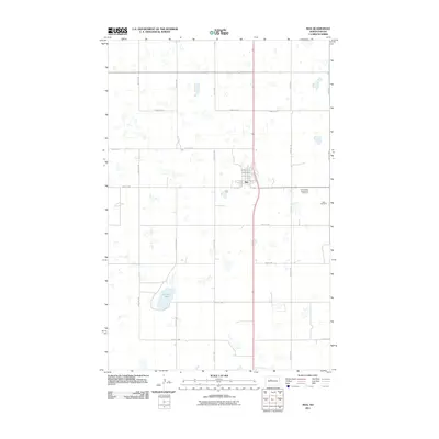
2011 Map of Max
USGS Topo · Published 2011About this map
Max serves as a central hub in McLean County, exhibiting the structured grid of a North Dakota prairie town at the turn of the decade. The town layout is clearly defined by local thoroughfares such as Andrew St, Flower St, and 3rd Ave, reflecting the organized growth typical of the region's agricultural communities. To the southeast, the Immaculate Conception Cemetery and Max Cemetery provide significant points of interest for genealogists and local historians, anchoring the community's lineage to the surrounding landscape.
Find a feature on this map
25 named features on this map. Tap any name to fly to it.
Don’t see what you’re looking for? This feature index may not catch every label — zoom into the map to look around manually.
Map Details
Editions of this 2011 Max Map
This is the sole edition of this map. No revisions or reprints were ever made.
Other maps of this area

1922 · Garrison
USGS Topo · 1:62,500

1929 · Coleharbor
USGS Topo · 1:62,500

1929 · Benedict
USGS Topo · 1:62,500

1954 · McClusky
USGS Topo · 1:250,000

1958 · McClusky
USGS Topo · 1:250,000
1974 · Garrison NW
USGS Topo · 1:24,000
1974 · Benedict NW
USGS Topo · 1:24,000
1974 · Benedict SW
USGS Topo · 1:24,000
1974 · Garrison NE
USGS Topo · 1:24,000
1974 · Coleharbor NW
USGS Topo · 1:24,000