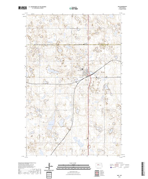
2024 Map of Max
USGS Topo · Published 2024About this map
Max serves as a central hub for the surrounding prairie landscape at the border of Ward and McLean counties. This agricultural and wetland region is dotted with numerous small bodies of water and significant conservation lands, most notably the McLean County Waterfowl Production Area. The town's grid is centered on Main St and Carvell St, with several religious institutions and community landmarks marking its boundaries.
Find a feature on this map
38 named features on this map. Tap any name to fly to it.
Don’t see what you’re looking for? This feature index may not catch every label — zoom into the map to look around manually.
Map Details
Editions of this 2024 Max Map
This is the sole edition of this map. No revisions or reprints were ever made.
Other maps of this area

1922 · Garrison
USGS Topo · 1:62,500

1929 · Coleharbor
USGS Topo · 1:62,500

1929 · Benedict
USGS Topo · 1:62,500

1954 · McClusky
USGS Topo · 1:250,000

1958 · McClusky
USGS Topo · 1:250,000
1974 · Garrison NW
USGS Topo · 1:24,000
1974 · Benedict NW
USGS Topo · 1:24,000
1974 · Benedict SW
USGS Topo · 1:24,000
1974 · Garrison NE
USGS Topo · 1:24,000
1974 · Coleharbor NW
USGS Topo · 1:24,000