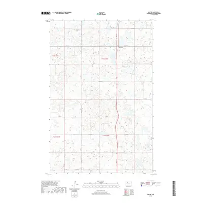
2018 Map of Max NE
USGS Topo · Published 2018About this map
Glacial prairie potholes and seasonal wetlands define this Ward County landscape as it appeared in the late 2010s. The terrain is a dense network of depressions and low rises, characteristic of the Drift Prairie, where natural drainage is minimal and water collects in countless small basins. Township Cem stands as the primary cultural landmark, located just south of 247th Ave SW and west of the intersection with 2nd St SW.
Find a feature on this map
23 named features on this map. Tap any name to fly to it.
Don’t see what you’re looking for? This feature index may not catch every label — zoom into the map to look around manually.
Map Details
Editions of this 2018 Max NE Map
This is the sole edition of this map. No revisions or reprints were ever made.
Other maps of this area

1928 · Minot
USGS Topo · 1:62,500

1929 · Sawyer
USGS Topo · 1:62,500

1929 · Benedict
USGS Topo · 1:62,500

1949 · Sawyer
USGS Topo · 1:62,500
1950 · Sawyer SW
USGS Topo · 1:24,000

1954 · Minot
USGS Topo · 1:250,000

1954 · McClusky
USGS Topo · 1:250,000

1958 · McClusky
USGS Topo · 1:250,000

1958 · Minot
USGS Topo · 1:250,000
1974 · Benedict NW
USGS Topo · 1:24,000