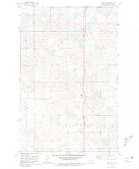
1980 Map of Max NE
USGS Topo · Published 1981About this map
Glacial potholes and prairie wetlands define the landscape of Ward County in the early 1980s, an area characterized by dispersed agricultural townships. The terrain is marked by the irregular boundaries of Gasman, Hilton, Rushville, and Spring Lake, reflecting the grid-based settlement pattern of the North Dakota plains. A prominent Radio Tower (KMOT-TV) stands as a modern landmark amidst the rolling hills, while the local Townhall and Township Cem serve as the primary civic and historical anchors for the surrounding farming community.
Find a feature on this map
10 named features on this map. Tap any name to fly to it.
Don’t see what you’re looking for? This feature index may not catch every label — zoom into the map to look around manually.
Map Details
Editions of this 1980 Max NE Map
This is the sole edition of this map. No revisions or reprints were ever made.
Other maps of this area

1928 · Minot
USGS Topo · 1:62,500

1929 · Sawyer
USGS Topo · 1:62,500

1929 · Benedict
USGS Topo · 1:62,500

1949 · Sawyer
USGS Topo · 1:62,500
1950 · Sawyer SW
USGS Topo · 1:24,000

1954 · Minot
USGS Topo · 1:250,000

1954 · McClusky
USGS Topo · 1:250,000

1958 · McClusky
USGS Topo · 1:250,000

1958 · Minot
USGS Topo · 1:250,000
1974 · Benedict NW
USGS Topo · 1:24,000