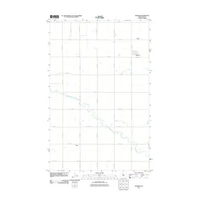
2011 Map of Maxbass
USGS Topo · Published 2011About this map
Maxbass serves as the primary hub of this Bottineau County landscape, situated amidst an orderly grid of section lines and rural corridors. The settlement's layout is clearly defined north of County Rd 20, while the Maxbass Cemetery sits further north along the path of County Rd 178. This 2011 survey illustrates the intersection of modern agricultural infrastructure and the natural meandering path of Cut Bank Creek, which snakes diagonally across the southern half of the quadrangle.
Find a feature on this map
23 named features on this map. Tap any name to fly to it.
Don’t see what you’re looking for? This feature index may not catch every label — zoom into the map to look around manually.
Map Details
Editions of this 2011 Maxbass Map
This is the sole edition of this map. No revisions or reprints were ever made.
Other maps of this area

1948 · Lansford
USGS Topo · 1:62,500

1949 · Glenburn
USGS Topo · 1:24,000

1949 · Lansford SE
USGS Topo · 1:24,000

1949 · Lansford NE
USGS Topo · 1:24,000

1949 · Maxbass
USGS Topo · 1:24,000

1949 · Eckman SE
USGS Topo · 1:24,000

1949 · Eckman
USGS Topo · 1:24,000

1949 · Westhope SW
USGS Topo · 1:24,000

1950 · Lansford
USGS Topo · 1:62,500

1950 · Westhope SW
USGS Topo · 1:24,000