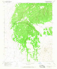
1966 Map of Maxson Crater
USGS Topo · Published 1968About this map
The Mora Mountains dominate the landscape of this mid-1960s survey, representing a significant topographical transition in northeastern New Mexico. Historically significant transit routes skirt the high ground, including the Santa Fe Trail (Mountain Route) and the Wagon Mound Cutoff, marking the paths of nineteenth-century commerce and migration. The southwestern corner of the map captures a portion of Fort Union National Monument, reflecting the area's strategic importance in the territorial era. To the east, the volcanic legacy of the region is evident in the prominent Maxson Crater and the adjacent Baldy Mountain. The drainage pattern is defined by seasonal watercourses like Cottonwood Creek and Turkey Creek, which carve deep canyons through the highlands. Small-scale features such as Needam Spring and Arroyo Needam provide insight into the localized water sources critical for ranching and settlement in this semi-arid environment.
Find a feature on this map
14 named features on this map. Tap any name to fly to it.
Don’t see what you’re looking for? This feature index may not catch every label — zoom into the map to look around manually.
Map Details
Editions of this 1966 Maxson Crater Map
This is the sole edition of this map. No revisions or reprints were ever made.
Other maps of this area

1889 · Las Vegas
USGS Topo · 1:125,000

1891 · Las Vegas
USGS Topo · 1:125,000

1892 · Watrous
USGS Topo · 1:125,000

1893 · Las Vegas
USGS Topo · 1:125,000

1894 · Watrous
USGS Topo · 1:125,000

1954 · Santa Fe
USGS Topo · 1:250,000

1954 · Raton
USGS Topo · 1:250,000

1958 · Raton
USGS Topo · 1:250,000

1958 · Santa Fe
USGS Topo · 1:250,000

1963 · Fort Union
USGS Topo · 1:24,000