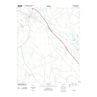
2010 Map of Maxton
USGS Topo · Published 2010About this map
The Lumber River and its intricate network of swamps and creeks dominate this corner of Robeson County. The town of Maxton serves as the primary hub, where residential blocks meet the industrial and agricultural landscape of the North Carolina coastal plain. Significant water management is evident at Maxton Pond Dam and Country Club Lake Dam, which control the flow of Shoe Heel Creek and smaller tributaries.
Find a feature on this map
74 named features on this map. Tap any name to fly to it.
Don’t see what you’re looking for? This feature index may not catch every label — zoom into the map to look around manually.
Map Details
Editions of this 2010 Maxton Map
This is the sole edition of this map. No revisions or reprints were ever made.
Other maps of this area

1949 · Laurinburg
USGS Topo · 1:24,000

1949 · Wakulla
USGS Topo · 1:24,000

1949 · Laurinburg
USGS Topo · 1:62,500

1953 · Florence
USGS Topo · 1:250,000

1954 · Florence
USGS Topo · 1:250,000

1957 · Laurinburg
USGS Topo · 1:24,000

1971 · Minturn
USGS Topo · 1:24,000

1971 · Johns
USGS Topo · 1:24,000

1972 · Pembroke
USGS Topo · 1:24,000
1972 · Rowland
USGS Topo · 1:24,000