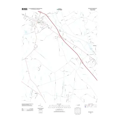
2013 Map of Maxton
USGS Topo · Published 2013About this map
Maxton serves as the primary hub of this landscape, situated at a major junction of modern transit and older waterways. The town's grid is dense with street names like Wilmington St and E Rockingham Rd, reflecting its role as a regional center of commerce and connection in Robeson County. To the southeast, the terrain transitions into a complex hydrological network where the Lumber River and Back Swamp define the land use.
Find a feature on this map
149 named features on this map. Tap any name to fly to it.
Don’t see what you’re looking for? This feature index may not catch every label — zoom into the map to look around manually.
Map Details
Editions of this 2013 Maxton Map
This is the sole edition of this map. No revisions or reprints were ever made.
Other maps of this area

1949 · Laurinburg
USGS Topo · 1:24,000

1949 · Wakulla
USGS Topo · 1:24,000

1949 · Laurinburg
USGS Topo · 1:62,500

1953 · Florence
USGS Topo · 1:250,000

1954 · Florence
USGS Topo · 1:250,000

1957 · Laurinburg
USGS Topo · 1:24,000

1971 · Minturn
USGS Topo · 1:24,000

1971 · Johns
USGS Topo · 1:24,000

1972 · Pembroke
USGS Topo · 1:24,000
1972 · Rowland
USGS Topo · 1:24,000