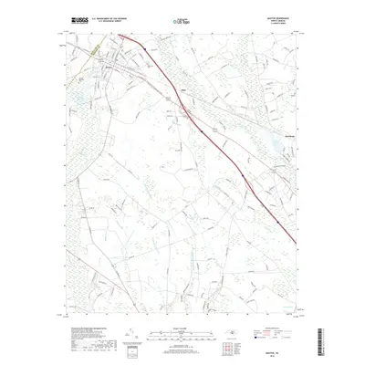
2019 Map of Maxton
USGS Topo · Published 2019About this map
Maxton sits at the intersection of commerce and hydrology along the border of Scotland and Robeson counties. This 2019 survey details a landscape defined by extensive wetland networks, where Back Swamp and Watering Hole Swamp weave through the rural coastal plain. The town of Maxton remains the primary hub, showing a grid of streets such as W Rockingham Rd and N McNair St, while smaller communities like Alma and Red Banks anchor the eastern reaches near the Lumber River.
Find a feature on this map
144 named features on this map. Tap any name to fly to it.
Don’t see what you’re looking for? This feature index may not catch every label — zoom into the map to look around manually.
Map Details
Editions of this 2019 Maxton Map
This is the sole edition of this map. No revisions or reprints were ever made.
Other maps of this area

1949 · Laurinburg
USGS Topo · 1:24,000

1949 · Wakulla
USGS Topo · 1:24,000

1949 · Laurinburg
USGS Topo · 1:62,500

1953 · Florence
USGS Topo · 1:250,000

1954 · Florence
USGS Topo · 1:250,000

1957 · Laurinburg
USGS Topo · 1:24,000

1971 · Minturn
USGS Topo · 1:24,000

1971 · Johns
USGS Topo · 1:24,000

1972 · Pembroke
USGS Topo · 1:24,000
1972 · Rowland
USGS Topo · 1:24,000