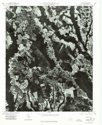
1976 Map of Maxton
USGS Topo · Published 1978About this map
Lumber River winds through the Robeson County landscape, anchoring a region defined by extensive agricultural fields and dense woodland. This 1976 orthophotograph, produced by the United States Geological Survey and the State of North Carolina Department of Natural and Economic Resources, captures the town of Maxton in detail, showing its grid of streets and industrial proximity. To the south, the smaller settlements of Seven Bridges and Raemon are visible among the mosaic of forest and farm plots. The map traces the primary transit corridors of the era, including Highway 74 and Highway 501, which connect these rural communities. By utilizing aerial imagery rather than traditional line-and-symbol cartography, this sheet provides a direct visual record of land use and timber harvesting patterns along the river bottomlands during the mid-1970s.
Find a feature on this map
6 named features on this map. Tap any name to fly to it.
Don’t see what you’re looking for? This feature index may not catch every label — zoom into the map to look around manually.
Map Details
Editions of this 1976 Maxton Map
This is the sole edition of this map. No revisions or reprints were ever made.
Other maps of this area

1949 · Laurinburg
USGS Topo · 1:24,000

1949 · Wakulla
USGS Topo · 1:24,000

1949 · Laurinburg
USGS Topo · 1:62,500

1953 · Florence
USGS Topo · 1:250,000

1954 · Florence
USGS Topo · 1:250,000

1957 · Laurinburg
USGS Topo · 1:24,000

1971 · Minturn
USGS Topo · 1:24,000

1971 · Johns
USGS Topo · 1:24,000

1972 · Pembroke
USGS Topo · 1:24,000
1972 · Rowland
USGS Topo · 1:24,000