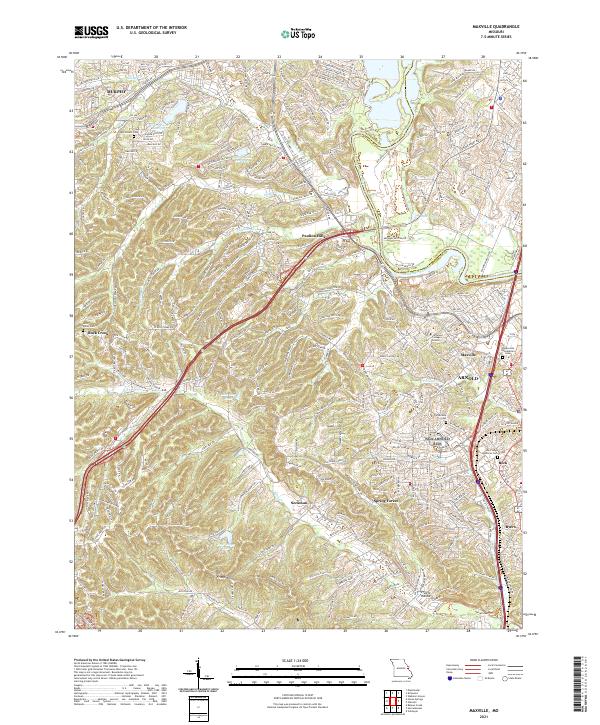
2021 Map of Maxville
USGS Topo · Published 2021About this map
The Meramec River winds through the northeast corner of this modern survey, defining the border between Jefferson and St. Louis counties. This suburban landscape south of St. Louis is marked by dense residential developments such as Murphy, Paulina Hills, and Spring Forest. Despite modern growth, traditional landmarks remain visible, including the Immaculate Conception Cem and Saint Johns Lutheran Cem. Higher elevations like Sugar Mountain and Frisco Hill punctuate the terrain, while the academic presence of Jefferson College Arnold serves as a local anchor near Arnold and Maxville. The area's hydrology is well-defined by numerous creeks, such as Romaine Cr, Saline Cr, and Pomme Cr, which flow through the undulating hills and valleys that characterize this portion of Missouri.
Find a feature on this map
305 named features on this map. Tap any name to fly to it.
Don’t see what you’re looking for? This feature index may not catch every label — zoom into the map to look around manually.
Map Details
Editions of this 2021 Maxville Map
This is the sole edition of this map. No revisions or reprints were ever made.
Other maps of this area

1901 · De Soto
USGS Topo · 1:125,000

1903 · O'Fallon
USGS Topo · 1:125,000

1912 · Kimmswick
USGS Topo · 1:62,500

1916 · Kimmswick
USGS Topo · 1:62,500

1930 · Pacific SE
USGS Topo · 1:24,000

1931 · Manchester SE
USGS Topo · 1:24,000

1931 · Pacific NE
USGS Topo · 1:24,000

1933 · Jefferson Barracks
USGS Topo · 1:24,000

1933 · Kirkwood
USGS Topo · 1:24,000
1940 · Kirkwood
USGS Topo · 1:24,000