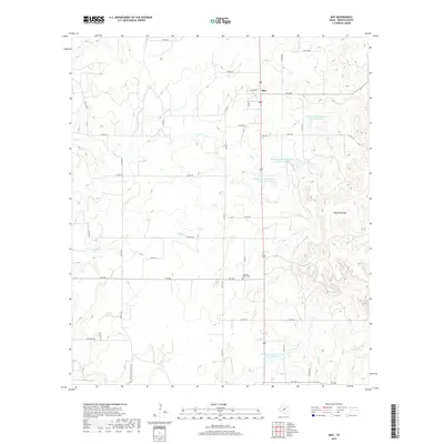
2019 Map of May
USGS Topo · Published 2019About this map
The settlement of May serves as the focal point for this section of Brown County, where the local economy and landscape are shaped by water management and ranching. A series of reservoirs, including Soil Conservation Service Site 31 Reservoir and Soil Conservation Service Site 32 Reservoir, highlight the region's 20th-century emphasis on flood control and irrigation along the drainage of Hog Cr. To the east, the Hog Mountains rise above the surrounding terrain, marking a distinct geographical break near Gap Cr. Genealogists and local historians will find significant value in the documentation of the May Cem and Pleasant Valley Cem, which anchor the historical community identity. The map also traces a network of farm-to-market roads, such as FM 1689 and FM 2273, that connect remote homesteads to the central Po in town.
Find a feature on this map
43 named features on this map. Tap any name to fly to it.
Don’t see what you’re looking for? This feature index may not catch every label — zoom into the map to look around manually.
Map Details
Editions of this 2019 May Map
This is the sole edition of this map. No revisions or reprints were ever made.
Other maps of this area

1887 · Coleman
USGS Topo · 1:125,000

1889 · Brownwood
USGS Topo · 1:125,000

1889 · Coleman
USGS Topo · 1:125,000

1894 · Eastland
USGS Topo · 1:125,000

1894 · Brownwood
USGS Topo · 1:125,000

1924 · Coleman 1-a
USGS Topo · 1:48,000

1924 · Brownwood Reservoir Site
USGS Topo · 1:48,000

1927 · Grosvenor
USGS Topo · 1:62,500

1931 · Baird
USGS Topo · 1:125,000

1932 · Baird
USGS Topo · 1:125,000